
Walk a San Angelo Street
For an address-first search, begin with the Tom Green CAD property address mode. It provides a parcel-level starting point, rather than a claim about every person on a block. Write down the situs address, Property ID, Geographic ID, owner name, mailing address, and legal description exactly as displayed. The CAD card can also supply land and improvement details, value rows, exemption indicators, and selected deed-history clues. A street-by-street review is slower than a name search, but it preserves the identifiers needed to compare one parcel with the next.
Then use the address as a chain, not a final answer. The current parcel card leads to a legal description; that description and the owner name can lead into a recorded instrument; the instrument can point to an earlier party. The county voter street index is useful for the range itself, but it is not a household roster. Historical directories may supply a dated address line. Each layer should be recorded with its source and date.
- Enter the numbered address in the Tom Green CAD Property Address mode and save the Property ID, Geographic ID, situs, mailing address, and legal description.
- Open the parcel map or City GIS to compare the address point with nearby parcels and the street segment.
- Use the legal description or owner name in EagleWeb. Note the grantor, grantee, recording date, reception number, and document type shown by the index.
- Check the county street index for the range, odd or even side, ZIP, precinct, and district fields that apply to that street.
- For a prior household question, compare a dated directory or census source with the deed and parcel trail, keeping uncertainty visible.
Note: A parcel owner, a tax correspondence address, and a resident are separate facts that should not be merged without a dated supporting record.
Search San Angelo Street Parcels
The free Tom Green CAD search is the strongest current-record starting point for a San Angelo street directory. It has separate search paths for Name, Property Address, Legal Description, Geographic ID, Property ID, and Map/GIS. Its name field is not a normal full-name box: enter the first part of a last name with at least two characters and no spaces. For a street task, the Property Address mode is more direct. The research did not confirm address normalization, unit handling, a street-wide export, or a public result cap, so search individual addresses and map-browse a segment instead of promising a complete street list.
| CAD search route | Input | Useful result | San Angelo note |
|---|---|---|---|
| Name | First part of surname, two or more characters, no spaces | Owner-record entry point | Use when an address search identifies a possible owner. |
| Property Address | Situs street text | Parcel card | Best starting route for a known street number. |
| Legal Description | Lot, block, subdivision, or description fragment | Parcel match | Useful when a deed does not state the modern street form. |
| Geographic ID | Exact identifier | Specific parcel | Carry it between CAD and map work. |
| Property ID | Exact ID, such as an R-number | Specific parcel | Most stable way to reopen a saved card. |
| Map/GIS | Map link | Parcel context | Interactive map controls were not fully documented in the text review. |
The CAD search landing page shows the address and identifier choices used in a San Angelo street directory search.
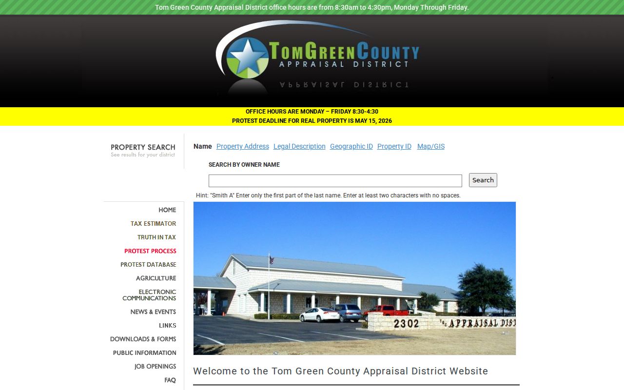
Use the mode that matches the information in hand, then retain the returned identifiers before moving to a deed or map source.
Keep San Angelo Address Forms
A San Angelo street directory needs three address columns from the first search. The situs address is the physical place used by CAD, GIS, permits, and many city services. The mailing address is where tax correspondence goes for the owner account. The legal description is the lot, block, subdivision, or metes-and-bounds wording used in deeds and plats. They can point to the same parcel while looking very different on paper.
Tom Green CAD’s inspected sample demonstrates the distinction: a San Angelo situs was paired with a Baird mailing address. That is a normal reason to preserve both fields, not evidence that a person lives at either one. Legal descriptions are particularly valuable when an older deed omits the present street address, when a street name is abbreviated, or when a historic addition provides the better connection.
- Parcel
- A mapped piece of land represented by a CAD identifier and boundaries. It is not a list of everyone associated with the address.
- Situs address
- The physical property location used for assessment and map context.
- Plat
- A recorded map that lays out a subdivision, lots, blocks, streets, or dedications.
- Criss-cross directory
- An address-arranged directory section, if a particular historical volume includes one. Local San Angelo runs were not verified for every year.
Browse San Angelo Street GIS
The City of San Angelo GIS adds map context, while the CAD parcel viewer supplies the parcel bridge. City layers identified in the research include addresses, zoning, water, sewer, river-corridor, transportation, and traffic-count information. Use those layers to orient a named street, compare an address to an adjacent parcel, or notice that an address lies near a district boundary. They do not establish title, transfer date, or present occupancy.
The GIS division is at 52 W College Ave. and lists 325-657-4210. Its map data are supplied as-is. Exact click, identify, buffer, and radius controls were not captured during the research, so a careful San Angelo street directory search should not claim a particular tool exists. Record the Property ID or Geographic ID from the map, then reopen the official CAD card and recorder index for the record evidence.
Follow San Angelo Street Deeds
Tom Green County Recorder EagleWeb is the legal-document bridge for an address trail. Its online index covers recordings from January 1, 1982 forward. Search the person named on the parcel card as a grantee to locate a purchase or transfer, then use the grantor and the same legal description to move backward. EagleWeb’s related-search feature can find documents that refer to the current document or share a legal description. An index result is a catalog entry, not a certified copy.
EagleWeb offers Grantor, Grantee, combined Grantor/Grantee, Reception Number, date range, document type, and Basic or Advanced name search. Basic name search requires last name first and preserves word order. Advanced search is word-order independent. The help page also documents * for variable characters, + to require a word, and - to exclude a word. Try spelling variants before treating a name as absent. The research did not confirm an export, sort option, or result cap.
The EagleWeb recorder interface presents the party, date, and document search routes for the San Angelo street directory deed trail.
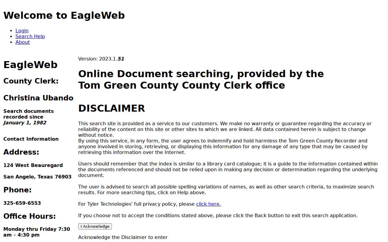
For an official copy or older material, contact the County Clerk rather than relying only on a watermarked online image.
Note: Older deed books and office research remain necessary for instruments before EagleWeb’s verified online coverage window.
Read San Angelo Street Ranges
The 2025 Tom Green County street index is a geography tool for a San Angelo street directory, not a list of people. Its fields connect From and To ranges, odd or even side, directional prefix and suffix, street name, type, city, ZIP, precinct, restriction, and several county, state, city, school, judicial, and board districts. That makes it a practical way to determine whether a number belongs in the expected range and which districts accompany it.
Store the ZIP and district fields separately. A postal city, a ZIP, a parcel, and a city-district assignment can differ. An address with San Angelo as its mailing city may be outside the municipal limit, and a blank city-district field on a voter certificate can be useful context. The index also does not establish household membership, party affiliation, or how anyone voted. Protected addresses remain subject to Texas restrictions.
The Texas My Voter Portal is the official status-lookup companion to the street-index geography.
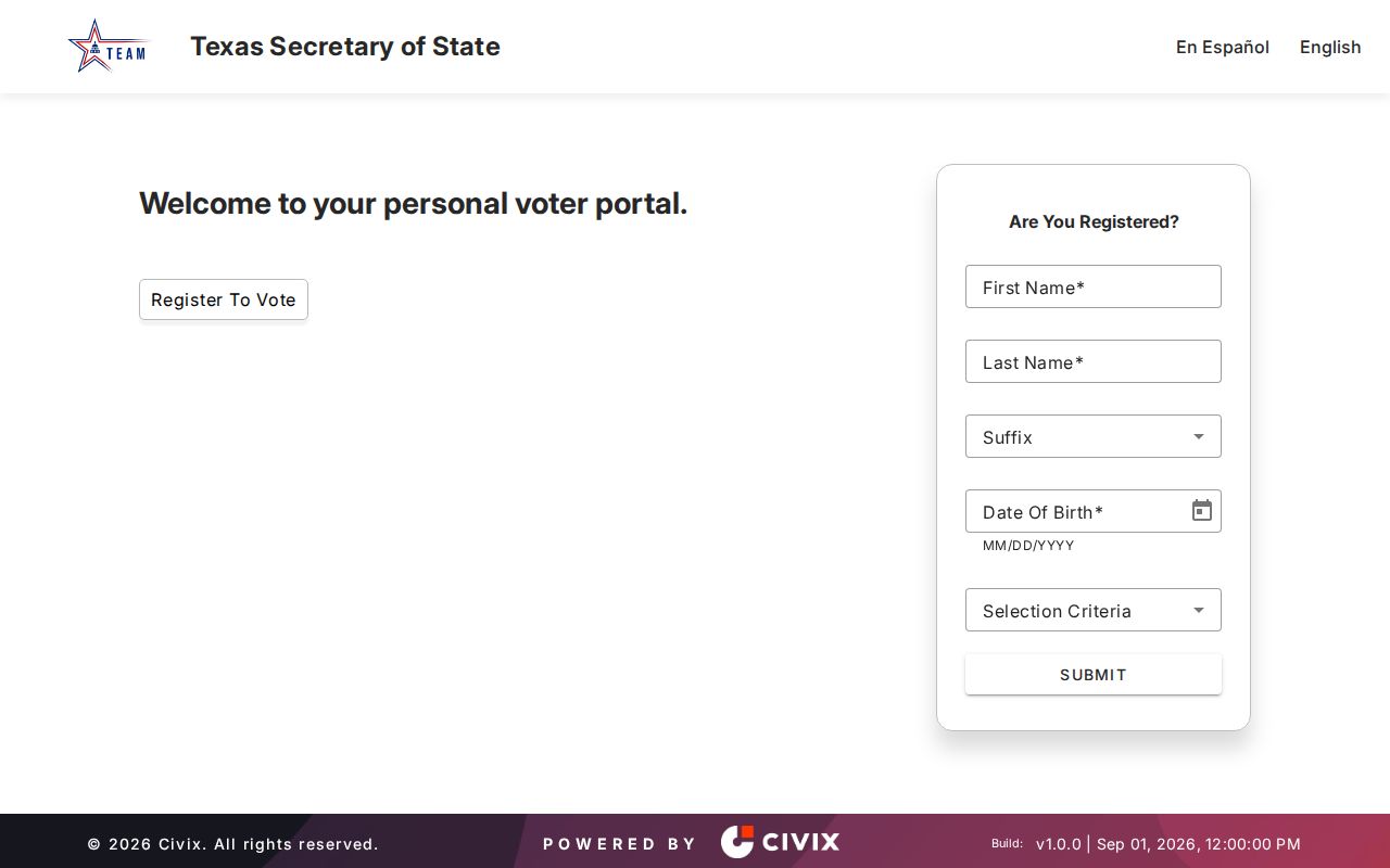
Use its name, VUID, or Texas license and ID routes only as the official interface requests, and do not treat a protected or absent display as evidence about a household.
Date San Angelo Street Work
San Angelo Building Permits and Inspections publishes monthly permit and inspection reports that can date physical work at an address. They can help place construction, additions, solar work, or an inspection event in sequence. The research found reports for several 2026 months, but it did not find a complete public address-searchable permit index. The monthly PDFs are therefore a dated lead, not a full property history.
For a missing file, use the city counter, email route, or a narrow Texas Public Information Act request that names the exact address, a time window, record type, and requested fields. A focused request for existing permit and inspection records may seek a permit number, issue date, status, inspection dates, and releasable names or addresses. Permit activity is not a transfer record, and an applicant can be an agent or contractor rather than an owner or occupant.
Use Older San Angelo Street Listings
Historical street work belongs in dated sources. The Tom Green County Library genealogy resources include microfilm, historical newspapers, census material, Sanborn maps, FamilySearch, HeritageQuest, Fold3, and library databases. A directory entry can tie a name and address to a publication year, but it does not prove ownership or a full household. Ask the library which San Angelo volumes have an address or criss-cross section, because the exact local reverse-directory years and shelf locations were not confirmed.
Worley and Polk directory runs, NARA microfilm, and FamilySearch are useful when a street question becomes a past-household question. The dated collections and their gaps belong to the San Angelo Directory Book; use them as a second layer after preserving the present parcel identifiers. Sanborn maps add a building, block, and street context, not a resident list.
Compare San Angelo Address Records
No single San Angelo street directory covers owners, occupants, transfer history, street ranges, and building events. These address-keyed sets overlap, but their limits matter. CAD and maps make a strong current parcel pair. EagleWeb connects parties and instruments. Elections supplies range geography. City permits can date work. Historical sources provide dated household clues when the exact volume or image is available.
| Address record | Custodian | Best use | Access path |
|---|---|---|---|
| CAD parcel card | Tom Green CAD | Current owner record, mailing and situs fields, legal description, property details | Free web card; CAD office for correction questions. |
| CAD and city GIS | CAD and City GIS | Parcel geometry, address context, adjacent parcels, zoning and utility layers | Interactive maps supplied as-is. |
| Recorded instrument | Tom Green County Clerk | Grantor, grantee, date, reception number, legal description, image | EagleWeb from 1982; clerk books and counter for older material. |
| Street index | County Elections | Range, odd or even side, ZIP, precinct, and district assignments | 2025 PDF and Elections office. |
| Permit or inspection | City Building Permits | Work and inspection dates tied to a project or address | Monthly reports plus counter or focused request. |
| Historic directory | Library, archive, or FamilySearch | Dated name, address, and occupation clues | Books, microfilm, licensed databases, and images. |
Check San Angelo Street Continuity
Do not invent a San Angelo street-renumbering year. The research did not locate an official year-specific city renumbering or renaming project. When a street number does not line up across sources, compare the 2018 and 2025 street indexes, the CAD address layer, the subdivision or addition name, lot and block, cross streets, deed instrument, and map sheet. Mark an inferred match as an inference.
The 2021 downtown historic survey points to additions including Lasker’s, Miles’s, Ellis, and Wickes, while a circa-1880 Frank Lerch map supplies an older place layer. Those labels can bridge a modern street address to deeds and maps more reliably than street text alone. San Angelo’s river, rail, Fort Concho, downtown-addition, Goodfellow, and Angelo State contexts also mean that older records may use landmarks or institutional address forms instead of the current postal form.
Limits of San Angelo Street Records
A street directory can identify a recorded owner, a tax mailing address, a parcel boundary, a deed party, or a dated directory entry. It cannot reliably identify every person in a household. Utility customer and delivery records are not ordinary public resident directories. DMV address data are restricted under the federal Driver’s Privacy Protection Act. A permit applicant, licensee, or business agent may have no ownership or occupancy role at the property.
Voter information has its own statutory rules. Public information is not a record of ballot choices, and protected voter addresses may be suppressed. A property card is also not occupancy proof. Homestead or other exemption fields may be consistent with owner occupancy, but the research specifically warns against treating them as conclusive evidence.
Lawful use. Use San Angelo address records for personal, historical, estate, civic, or property-curiosity research. Do not use any record to stalk, harass, intimidate, or harm a person, and respect protected-address limits.
Note: Confirm a material fact with the office that holds the source record before relying on a parcel card, index result, street range, or map layer.