
San Angelo ZIP Code Coverage
Eight codes serve San Angelo and the Goodfellow-area mail geography: 76901, 76902, 76903, 76904, 76905, 76906, 76908, and 76909. The Texas postal-code list establishes that set, but it does not draw neighborhood lines. The useful first distinction is between codes commonly used with street service and codes that appear to follow a PO-box or institutional convention. A ZIP result is a routing result. It is not a count of people, a parcel boundary, or proof that an address is within the City of San Angelo.
| ZIP | Areas Covered | Post Office | Notes |
|---|---|---|---|
| 76901 | San Angelo postal area | San Angelo postal routing | Standard city code; confirm any street range with USPS. |
| 76902 | San Angelo postal area | San Angelo station, 1 N Abe St. | May be PO-box-oriented; use USPS exact-address confirmation. |
| 76903 | San Angelo postal area | San Angelo postal routing | State list code; street-index ranges add local context. |
| 76904 | San Angelo, Southwest station service area | Southwest Post Office, 3201 Loop 306 | Station address is 76904-9998; individual addresses still need verification. |
| 76905 | San Angelo postal area | San Angelo postal routing | Street-index examples include Tempe Post Drive ranges. |
| 76906 | San Angelo postal area | Current station assignment not confirmed | May be PO-box-oriented; use USPS exact-address confirmation. |
| 76908 | Goodfellow AFB and San Angelo area | Goodfellow AFB station | Military-installation address context; USPS controls delivery eligibility. |
| 76909 | San Angelo and Angelo State University addressing | ASU Station PO Boxes | Institutional and PO-box convention, not a general street-area claim. |
The Southwest station is at 3201 Loop 306, San Angelo, TX 76904-9998. The Goodfellow location is at 161 Nuchols St Unit 102, Goodfellow AFB, TX 76908-3352. These are useful postal reference points, yet neither station address should be used to infer coverage for a nearby street. The operational answer for a specific delivery point comes from the current USPS address lookup.
San Angelo Postal Service Cautions
Two codes deserve extra care. Research identifies 76902 and 76906 as possibly PO-box-oriented, with the current classifications not fully confirmed in the captured USPS material. Treat either as a prompt to check the whole address in USPS, not as a resident-area label. The city-area survey in the San Angelo MPO material lists 76901, 76903, 76904, 76905, 76908, and 76909, while omitting 76902 and 76906. That contrast supports a practical distinction, but it does not establish a fixed boundary.
Goodfellow AFB has its own 76908 address context. Angelo State University uses 76909 institutional formatting, including forms such as “ASU Station 11221 San Angelo TX 76909-1221.” These local conventions explain why a search based only on a code may produce an incomplete picture. Keep the source wording and punctuation when comparing a campus box, a county-road address, and a parcel’s physical, or situs, address.
San Angelo Street Index Geography
The 2025 Tom Green County voter street index is the strongest local bridge from a ZIP to address ranges. Its rows combine From and To numbers, odd or even side, directional fields, street name and type, city, ZIP, precinct, and several district columns. It is not a household roster. Instead, it reveals how a range is classified for election purposes and gives a practical way to compare a postal code with a street segment.
The index includes examples such as TCU Avenue in 76904, Tempe Post Drive in 76905, Templin Court and Road in 76904, and Texas Avenue in 76903. Capture the range and the ZIP beside it. Then retain the precinct and city-district fields too, because those values can differ from a postal-city label. Comparing the 2018 and 2025 editions can expose changed ranges or assignments without claiming that a code itself moved.
| Street-index field | How it helps a ZIP search |
|---|---|
| From / To and O/E | Matches a street number to the proper range and side of the street. |
| Street name, type, and direction | Preserves the local address form before comparing it with CAD or USPS. |
| ZIP | Supplies the range-level postal value published by County Elections. |
| Precinct and district columns | Shows that election geography is a separate layer from postal routing. |
Find San Angelo Residents by ZIP
A ZIP narrows the starting area, but no verified San Angelo portal offers a complete resident list by ZIP. Tom Green CAD exposes Name, Property Address, Legal Description, Geographic ID, Property ID, and Map/GIS modes. A confirmed ZIP filter was not visible. Use the street index to identify a likely range, search the physical address in CAD, and then let the property card and USPS result answer their separate questions.
- Run the full street address through USPS and save the returned postal city, ZIP, and ZIP+4 if supplied.
- Locate the address range in the 2025 voter street index and note the ZIP, precinct, and district columns.
- Search Tom Green CAD by Property Address to obtain the situs address, recorded owner, mailing address, legal description, or lot/block and bounds wording used in deeds, and Property ID.
- Compare the three results without merging them. USPS supplies delivery context, the index supplies range and district context, and CAD supplies parcel context.
- Use the parcel’s street and legal description for deeper address work when the postal code alone is too broad.
The voter street index carries ZIPs and ranges, not a complete list of people at each block. Texas voter status and file access are also subject to statutory protection rules. A name from another source should therefore be verified against the record relevant to the question, rather than inferred from a range alone. For a longer address-by-address chain, use the San Angelo Street Directory.
The Tom Green CAD search shows the address, owner, legal-description, identifier, and Map/GIS routes used after ZIP research narrows a location.
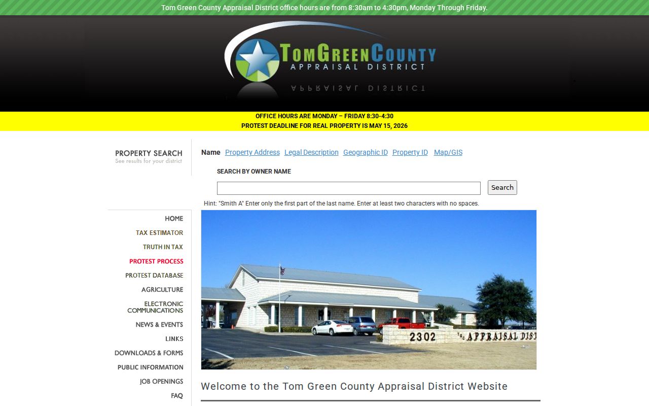
The parcel card adds property context, but its owner and mailing fields should not be converted into a claim that a person lives at the situs.
Verify a San Angelo ZIP Code
USPS is the operational authority for whether a particular address receives a particular code. The postal service warns that changes can take 30 to 60 days to appear in lookup tools. Record the date of the query and retain the exact return. If USPS, the CAD card, and the voter street index differ, preserve all three values and identify the source of each one rather than forcing a single answer.
The USPS Southwest Post Office location identifies the Southwest station associated with 76904 service information.
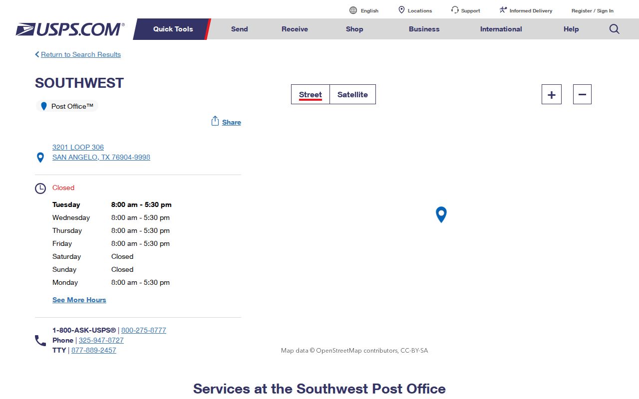
The station listing is a useful confirmation of local postal service context. It does not replace a USPS result for a specific home, campus box, or Goodfellow address.
San Angelo ZIP Code Limits
A postal city and a municipal limit are different geographies. The 2019 City Annexation Plan said the city did not then intend to annex territory requiring a plan, while retaining the ability to amend that position. That is useful context, not proof of any one address’s city status. A location can use San Angelo as its postal city and still fall outside the municipal limit, near a city or county boundary, or in a different school district.
The street index and voter certificate are practical checks. A blank city-district field on a certificate can signal an address outside city limits, and the index includes city and district columns alongside ZIP. The City GIS offers address and district layers, but the research did not confirm a ZIP-wide query in the text capture. CAD, GIS, and USPS therefore answer different parts of the same address question.
- ZIP code
- A postal routing code assigned by USPS, not a city boundary or a list of people.
- ZIP+4
- An added four-digit delivery detail returned for an exact address when USPS supplies it.
- PO-box ZIP
- A code used for post-office-box service; it should not be treated as a street-service boundary without address confirmation.
- Institutional ZIP
- A postal convention associated with an organization, such as the ASU Station use of 76909.
- Carrier route
- A delivery-routing grouping. It is not the same as a parcel, precinct, or municipal district.
San Angelo Parcel and ZIP Trail
Tom Green CAD is the bridge from a usable street address to the parcel record. Its card can show the recorded owner, mailing address, situs address, legal description, values, exemptions, land and improvement details, deed-history clues, and tax-estimate entities. The mailing address can be outside San Angelo. The research sample has an Avenue D situs in San Angelo and a Baird mailing address, which is why a parcel’s correspondence address should not be relabeled as the physical location.
When a parcel needs title context, search the recorded owner in the County Clerk’s EagleWeb index as grantor or grantee and compare the legal description. EagleWeb’s online recorded index begins January 1, 1982; earlier books and office research are not fully represented online. This is a record trail, not a ZIP filter. The legal description can connect the parcel when the street form, a historic number, or a postal label changes.
Note: Retain USPS, street-index, and CAD values separately because each describes a different local geography and may change on a different schedule.
Using San Angelo ZIP Records Carefully
ZIP research works best when the question is narrow: confirm a delivery code, compare a street range, or orient a parcel search. It works poorly when treated as a promise that every person, property, or organization in a broad area will appear in one result. The Chamber member directory, parcel cards, and voter range index count different kinds of records, so combining them into a single ZIP total would be misleading.
For personal family research, a complete address can also guide a search for a historic directory entry, cemetery record, or newspaper notice. Those sources have their own date limits and naming conventions. A code narrows the present-day geography, while a legal description, historic addition name, or source image may carry the stronger connection across time.